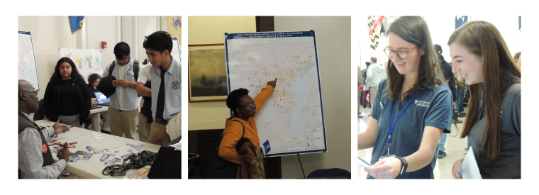
Baltimore City hosted its Annual GIS Day on Friday, November 15th at the War Memorial Building downtown. The event showcased the geospatial and mapping work being done in Baltimore by city agencies and other local organizations.
The gathering included a wide display of data, technology and GIS work open to the public for review and discussion. It also created a platform for exhibitors and attendees to collaborate and share GIS practices with each other.
Exhibitors included many city agencies, MD iMap (MD Department of IT), BMC, Johns Hopkins, and the Baltimore Neighborhood Indicators Alliance. Among the over 300 attendees were city employees from many agencies, members of the community, and students.
The Baltimore Metropolitan Council was excited to be included in the event presenting maps and apps created by our GIS team that illustrate information about the city and its relationship to the broader region. We also spoke about our work in general and how it benefits the city and the region.
At our table, we gave away maps that showed travel patterns to and from the city. This allowed guests to understand where people who work in Baltimore commute from, and where people living in the city go to work.
We also presented our regional bicycle facilities map, which attracted many throughout the day. Attendees were interested in seeing bicycle trails in their neighborhood and comparing facilities across different counties.
Another popular display was our interactive traffic dashboard. I Participants entered their address into the application to look at traffic conditions in their area. This led to conversations about what else BMC was doing to address the issue, including traffic safety and congestion management.
The event welcomed Digital Harbor GIS Track students. The students learned more about professional GIS work. Each student visited the map and data-covered tables, where exhibitors were eager to share their wealth of knowledge and answer questions to encourage their growth and development within the field. While many learned new information about map and data resources from visiting the BMC table, we are proud to note that the students from Digital Harbor plan to use BMC's open data for their school projects.
This is the first year BMC’s GIS team participated in this event. We are fortunate to communicate through our research, data and strategies just how interconnected our region is. We look forward to next year’s event and all that we can learn, give and discuss with next year’s attendees.
 |